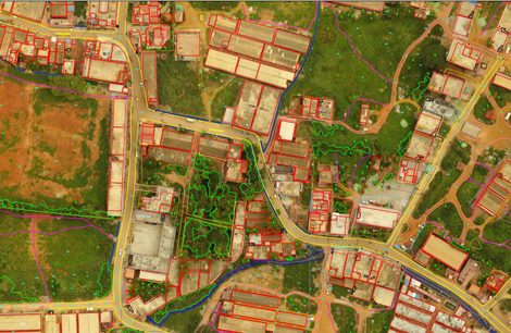
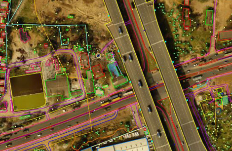
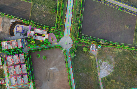
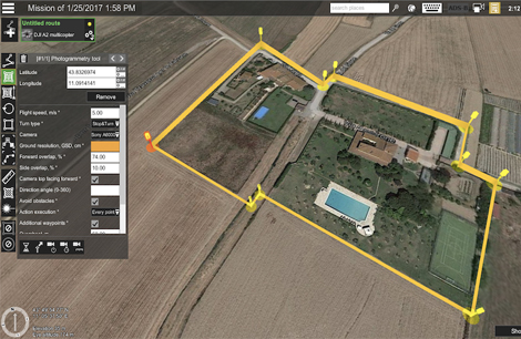
UAV/Drone Services are transforming industries by providing fast, cost-effective, and highly accurate solutions for data collection, analysis, and monitoring. Drones, equipped with advanced cameras, sensors, and GPS, are capable of capturing detailed aerial imagery, videos, and real-time data, making them indispensable tools for a wide range of applications. These services are utilized in fields such as agriculture, construction, surveying, environmental conservation, public safety, and infrastructure inspection.UAVs are ideal for accessing hard-to-reach or hazardous areas, reducing risks to human workers while delivering precision and efficiency. From creating high-resolution maps and 3D models to monitoring crop health and inspecting industrial assets, drone services offer unparalleled versatility. Their ability to provide real-time insights supports better decision-making, cost savings, and improved operational efficiency across industries.
UAV / DRONE Services
UAV / DRONE Services

Key UAV/Drone Services include:
- Aerial Mapping and Surveying
- Inspection Services
- Agricultural Monitoring.
- Environmental Monitoring.
- Disaster Response and Recovery
- Construction Progress Monitoring.
- Surveying and Volume Calculations.
- Security and Surveillance.
Back to top