Topographic Survey
Topographic Survey
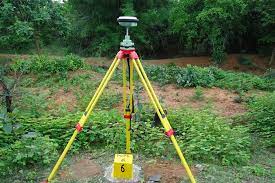
A Topographic Survey is a survey that gathers data about the elevation of points on a piece of land and presents them as contour lines on a plot. The purpose of a topographic survey is to collect detailed information about the natural and man-made features of the land, along with its elevations. Topographic maps are essential for showing elevations and grading features, aiding architects, engineers, and building contractors in planning and designing their projects.
SSIG Geospatial World Pvt. Ltd.'s professional land surveying team is highly skilled in the intricacies of topographic surveying. By leveraging the latest in surveying technology, SSIG’s land surveyors deliver accurate and consistently reliable topographic surveys, helping to streamline the construction process and save both time and money.