Digital Photogrammetry is a modern technique used for creating accurate 3D models, maps, and measurements by analyzing photographs. It involves capturing multiple overlapping images of an object, terrain, or structure from different angles, which are then processed using specialized software. The software identifies common points in the images to reconstruct the spatial geometry in three dimensions. This method has revolutionized fields such as surveying, architecture, archaeology, and environmental monitoring by providing high-precision results in a cost-effective and time-efficient manner. Digital photogrammetry leverages advancements in camera technology, GPS, and computer algorithms, making it a cornerstone of modern geospatial analysis and remote sensing.
Digital Photogrammetry
Digital Photogrammetry
Aerial Triangulation in Photogrammetry is the method of determining and calculating 3-dimensional object coordinates by photogrammetric means,by using photographs exposed from different positions, covering the same object.
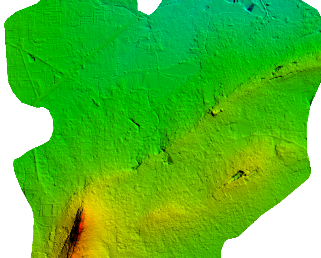
A digital elevation model is a regularly-spaced bare-earth raster grid referenced to a common vertical datum. When you filter out non-ground points such as bridges and roads, you are left with a smooth digital elevation model.
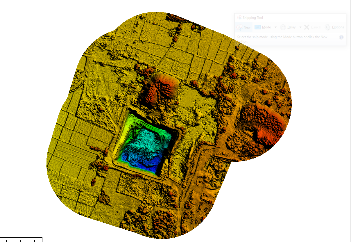
DSM measures the height values of the first surface on the ground. This includes terrain features, buildings, vegetation and power lines etc. DSM therefore provides a topographic model of the earth's surface.
Digital Terrain Modelling (DTM) is the collection of mass points of elevations and 3D breaklines at each change of terrain using Summit Evolution softcopy workstations.
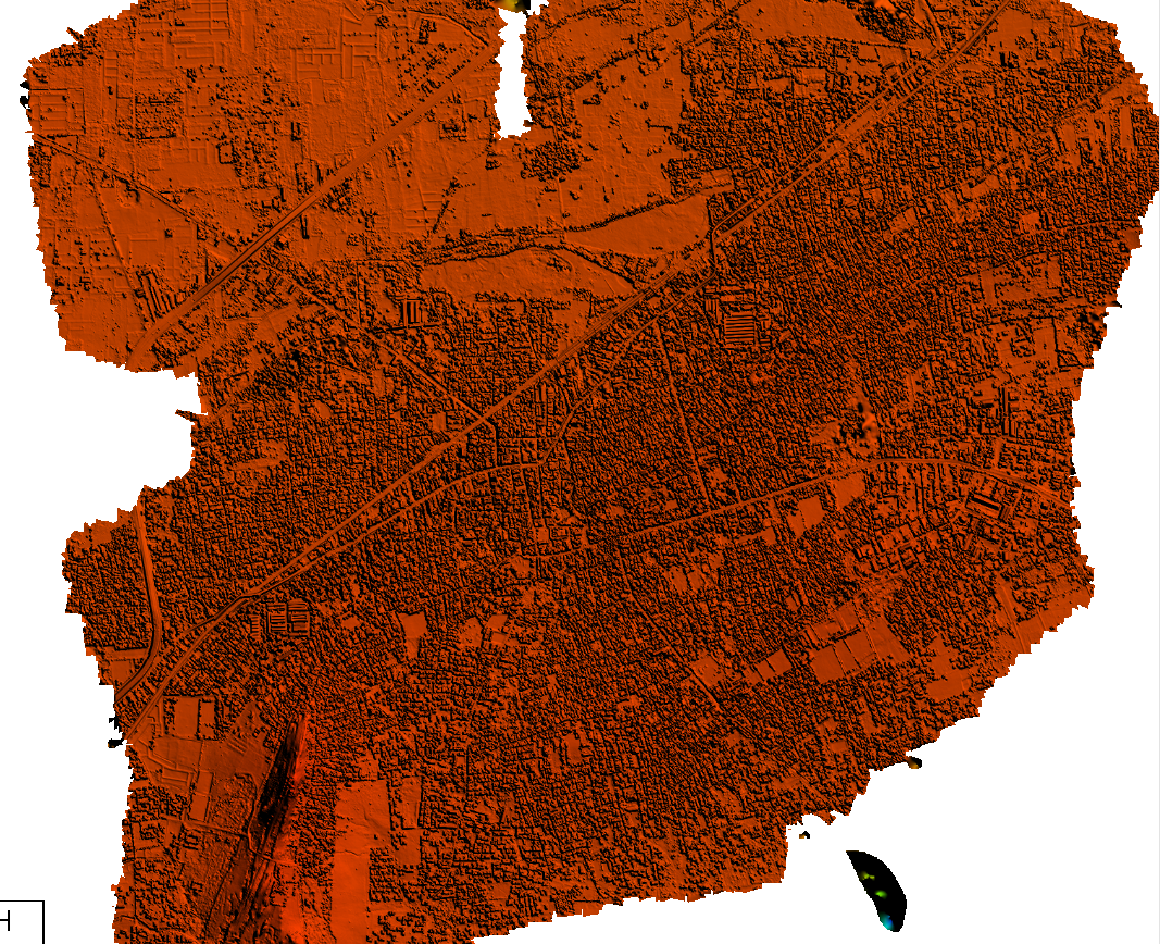
Planimetric maps develops natural features with their exact coordinate locations. These features are comprised of vegetation, trails, fences, utility poles, drainage systems, driveways, road boundaries and curbs.
Topographic maps are detailed, accurate graphic representations of features that appear on the Earth's surface. These features include:
- Cultural
- Hydrography
- Relief
- Vegetation
Volume Calculation in Digital Photogrammetry is a valuable service widely used in industries such as construction, mining, agriculture, and environmental management. By capturing overlapping images of an area or object from various angles, photogrammetric software generates detailed 3D models and topographic maps.
Contours are commonly in vector formats (e.g., shape file, dxf) and derived from a reconstructed TIN of DEM . Contours are among the most commonly used representations for elevations.
We provide accurate digital planimetric feature extraction for cartography mapping and 3D topo mapping in industry accepted standard formats.
GIS Update Mapping Using Digital Photogrammetry is a cutting-edge approach to keeping geographic information systems (GIS) accurate and up-to-date. By capturing high-resolution aerial or terrestrial images, photogrammetry generates detailed and precise spatial data, which can be seamlessly integrated into GIS platforms.
Timely and accurate change detection of Earth's surface features is extremely important for understanding relationships and interactions between human and natural phenomena in order to promote better decision making. Remote sensing data are primary sources extensively used for change detection in recent decades.