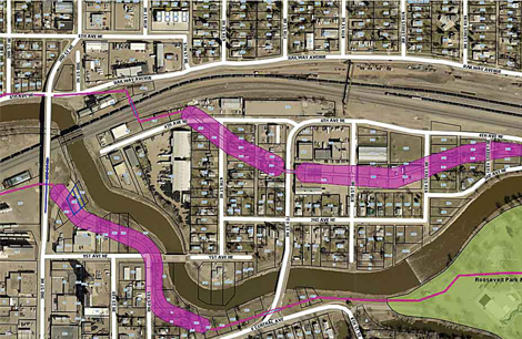
Railways throughout the world differ dramatically in size, type of operation and the environment in which they operate, yet all are asset-intensive corridors. SSIG Geo spatial asset mapping services provide customers with the information needed to ensure the safe and uninterrupted operation of railway corridors. Recognizing that construction, modification and maintenance of railway corridors add to operating expenses for rail operators,SSIG Geo spatial has developed a unique combination of technologies to provide cost-effective solutions that assist railway operators in managing their valuable right-of-way assets from city centers to remote rural areas
Railway
Railway
The railway industry relies on precision, safety, and efficiency to meet the growing demands of transportation and logistics. GeoSpatial World Private Limited leverages advanced geospatial technologies to transform railway operations by providing comprehensive observation and analysis solutions. From infrastructure monitoring to route optimization, our services ensure seamless railway operations with enhanced safety and cost efficiency.

Key Geospatial Solutions
| Solution | Description |
|---|---|
| Route Planning & Optimization | Using GIS for optimal railway route selection based on topography, population density, and land-use data. |
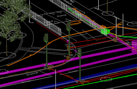
| Track Monitoring & Maintenance | Leveraging remote sensing and GIS to monitor the condition of railway tracks, including detecting potential faults, cracks, and wear. |
| Signaling & Safety Systems | Mapping and managing signaling infrastructure to ensure safe train operations, reducing delays and preventing accidents. |
| Train Scheduling & Operations | Analyzing geospatial data to optimize scheduling, reduce delays, and improve operational efficiency. |
Back to top