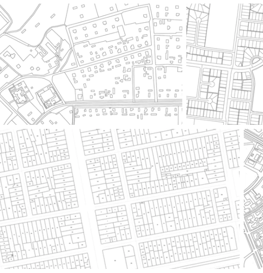
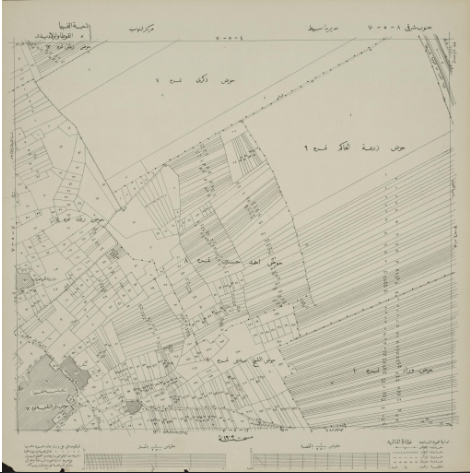
A cadastral map is a detailed representation that outlines the boundaries, ownership, and other critical aspects of land parcels. It typically includes parcel boundaries, identified by clear lines that delineate individual plots of land. Each parcel is assigned a unique identifier, such as a parcel number or lot number, which helps with tracking and administrative purposes. Ownership details, including the names of landowners, may also be displayed. Additionally, cadastral maps often feature zoning information that indicates how the land can be used (e.g., residential, commercial, industrial), along with any legal restrictions on development. Natural features like rivers, lakes, and topography may be shown, as well as man-made infrastructure such as roads, utilities, and access points. Survey markers and control points are commonly included to ensure accuracy and precision in locating parcels.
Cadastral Map
Cadastral Map

Back to top